- CA BWGPL WEG-Mar-OS9570
- Stuk
- 2000s
Part of WEGWHIST Collection
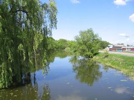
A view of the Marsh Canal looking north from the 5th line bridge.
81 results with digital objects Show results with digital objects
Part of WEGWHIST Collection
A view of the Marsh Canal looking north from the 5th line bridge.
Part of WEGWHIST Collection
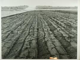
Freshly broken marshland in 1946. The break in the tree line is for Highway 400.

Part of WEGWHIST Collection
Mechanized harvesting. If you have any additional information about this photo please contact the library at 905-775-3328.
Part of Local History Collection
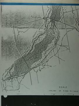
This map shows the area of the marsh that was wooded and the area that was grassy in 1895 as well as the boundaries.
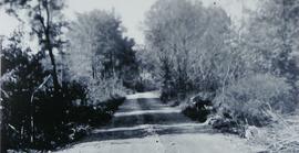
Canal Road prior to Hurricane Hazel
Part of Local History Collection
Dyke before Hurricane Hazel looking west from 416 Canal Rd.
Zonder titel
Part of Local History Collection
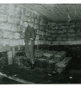
Bushels of carrots in storage following Hurricane Hazel.
Zonder titel
Springdale Christian Reform Flooded
Part of Local History Collection
View towards Springdale Christian Reformed Church from Hillsview Road.
Zonder titel

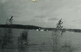
Springdale Christian Reformed Church Flooded
Part of Local History Collection
Springdale Christian Reformed Church underwater.
Zonder titel
Part of Local History Collection
One year after Hurricane Hazel, before the canal was dug out.
Zonder titel
Part of Local History Collection
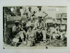
Marsh Families Rol Family, Market Gardeners Front: Peter Rol and Martin Rol's wife. Middle: Martin's child, Mary Rol, Gordon Bantam, Mag Oglioin, Mr. Addley. Back: John Rol, Martin Rol.