- CA BWGPL LHC-Rura-BondHead-OS9704
- Item
- 1868
Part of Local History Collection
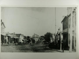
Looking east from the four corners of Bond Head down Hwy 88 around 1868.
343 results with digital objects Show results with digital objects
Part of Local History Collection
Looking east from the four corners of Bond Head down Hwy 88 around 1868.
Part of Local History Collection
Bond Head - looking east from the townline in 1868. The first store on the left is part of old Robinson Hotel. All the buildings from there past the buggies were burned in 1880.
Part of Local History Collection
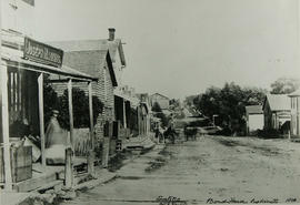
Bond Head looking south on highway 27 from 88 in 1868. Showing board sidewalks, looking south, which extended to the 6th Line. Note the boardwalk joining the road to the sidewalk.
Another version of this image was listed as 1867.
Part of Local History Collection
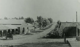
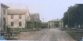
Looking west down main street in Bond Head. Brazill Hotel (now Bond Head Hotel) two windows over the buggy shed were for the 75-foot dance hall built over the shed.
Part of Local History Collection
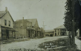
The main street of Bond Head with a good view of the hotel on #27
Part of Local History Collection
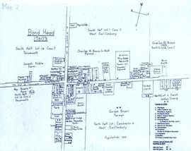
A map of Bond Head in the 1960's, including the main residents, active churches, and lot designations of the town.
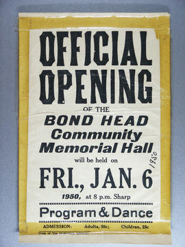
Flyer for the official opening of the Bond Head Community Memorial Church.
Part of WEGWHIST Collection
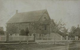
Bond Head Methodist Church 1873-1942 which was destroyed by fire.
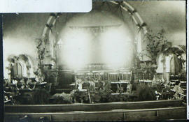
Bond Head Methodist Church Interior
Part of WEGWHIST Collection
Harvest Home Celebration at the Bond Head Methodist Church in 1911.
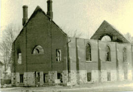
Bond Head Methodist Church ruins
Part of WEGWHIST Collection
The third Bond Head Methodist Church after it was destroyed by fire. The fire began in a nearby garage owned by William Jardine. Residents formed a bucket brigade to put out the blaze.