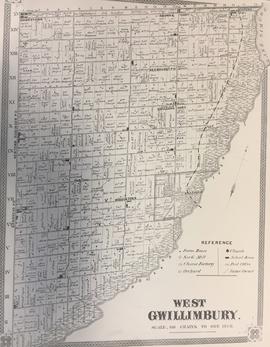
Township of West Gwillimbury Map c.1878
- CA BWGPL LHC-Map-2019-01-08-01
- Item
- 1878
Part of Local History Collection
Map of what West Gwillimbury looked like in approx. 1878.
Miles & Company
Township of West Gwillimbury Map c.1878
Part of Local History Collection
Map of what West Gwillimbury looked like in approx. 1878.
Miles & Company
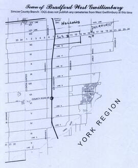
Part of Local History Collection
Map showing the Hollows and Deerhurst.
Bradford West Gwillimbury Public Library
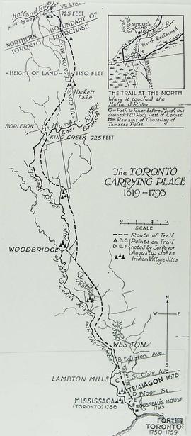
Map of the Toronto Carrying Place
Part of Local History Collection
Bradford West Gwillimbury Public Library
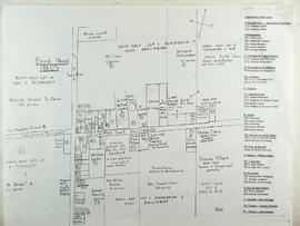
Part of Local History Collection
This drawing is a map of Bond Head in the 1860's based on historical data of the era.
Part of Local History Collection
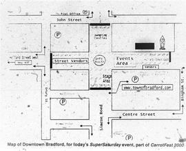
Map of how Downtown Bradford would be set-up for Carrotfest, printed in the Bradford West Gwillimbury Times.
Bradford West Gwillimbury Times
Part of Oral History Collection
Summary of an interview with Sam Neilly. The interviewer is George Jackson. Sam and George discuss where Sam's friends and family lived in accordance with a map of Gilford they are looking at. See the Related Descriptions below for summary.
Bradford West Gwillimbury Public Library Archives
Part of Local History Collection
Index to the Map & Plan Collection held in the Bill & Erica Marks Archive Room.
Bradford West Gwillimbury Public Library Archives
Part of Local History Collection
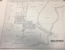
Map of what Bradford looked like in approx. 1878.
Miles & Company
Part of Local History Collection
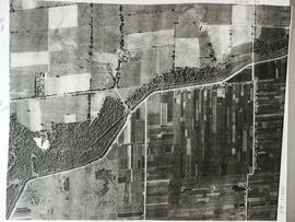
Aerial View of the 5th Line and Simcoe Rd in Bradford West Gwillimbury.
Bradford West Gwillimbury Public Library
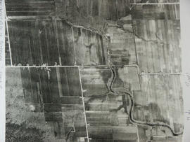
Aerial View - Road to Bradford
Part of Local History Collection
Aerial view of the direct road to Bradford, West is at the top of the page and North is on the right. Keele Street comes in form the left and Simcoe Road comes in from the right
Bradford West Gwillimbury Public Library