- CA BWGPL LHC-Map-OS11377
- Item
- 1860s
Part of Local History Collection
This drawing is a map of Bond Head in the 1860's based on historical data of the era.
Part of Local History Collection
This drawing is a map of Bond Head in the 1860's based on historical data of the era.
Part of Local History Collection
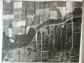
Aerial view of Coulson's Hill before 1960.
Bradford West Gwillimbury Public Library
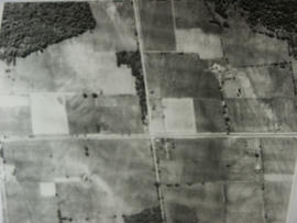
Aerial View - Road to Bradford
Part of Local History Collection
Aerial view of the direct road to Bradford, West is at the top of the page and North is on the right. Keele Street comes in form the left and Simcoe Road comes in from the right
Bradford West Gwillimbury Public Library
Part of Local History Collection
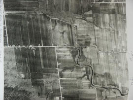
Aerial View of the 5th Line and Simcoe Rd in Bradford West Gwillimbury.
Bradford West Gwillimbury Public Library
Part of Local History Collection
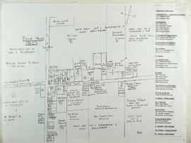
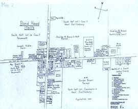
A map of Bond Head in the 1960's, including the main residents, active churches, and lot designations of the town.
Part of Local History Collection
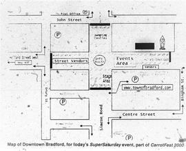
Map of how Downtown Bradford would be set-up for Carrotfest, printed in the Bradford West Gwillimbury Times.
Bradford West Gwillimbury Times
Part of WEGWHIST Collection
Contains items relating to the Early Settlement of Bradford and West Gwillimbury. Headings include:
Early Settlers General 1 of 3
Early Settlers General 2 of 3
Early Settlers General 3 of 3
Early Maps of Township
*East Gwillimbury & King Township
WEGWHIST Collection
Part of WEGWHIST Collection
Contains information on the various hamlets around Bradford. Headings include: Amsterdam Ansnorsveldt Bond Head BWG and Surrounding Area Cookstown Coulson's Hill Deerhurst Dunkerron Fennel's Corners Fisher's Corners Gilford 1 of 2 Gilford 2 of 2 Holland Landing The Hollows Innisfil Lefroy Mackie's Corners Middleton 1 of 2 Middleton 2 of 2 Mount Pleasant Newton Robinson Pinkerton Scotch Settlement Steele's Corners Springdale Tecumseth Township Thompsonville (Beeton area) Hamlets - Other
WEGWHIST Collection
Part of Local History Collection
Index to the Map & Plan Collection held in the Bill & Erica Marks Archive Room.
Bradford West Gwillimbury Public Library Archives
Joseph Street (by Registered Plan 122A)
Part of Local History Collection
Copy of part of a map of Joseph Street as part of Registered Plan 122A. Captured in the copy is a couple of handwritten notes, including the name "John Bateman."
Unknown