- CA BWGPL JS-Vol3-JSC-v3-1910
- Item
Part of Joe Saint fonds
Contains maps of the Bradford West Gwillimbury & surrounding areas
Joe Saint
17 results directly related Exclude narrower terms
Part of Joe Saint fonds
Contains maps of the Bradford West Gwillimbury & surrounding areas
Joe Saint
Part of WEGWHIST Collection
Contains items relating to the Early Settlement of Bradford and West Gwillimbury. Headings include:
Early Settlers General 1 of 3
Early Settlers General 2 of 3
Early Settlers General 3 of 3
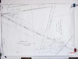
Early Maps of Township
*East Gwillimbury & King Township
WEGWHIST Collection
Part of WEGWHIST Collection
Contains information on the various hamlets around Bradford. Headings include: Amsterdam Ansnorsveldt Bond Head BWG and Surrounding Area Cookstown Coulson's Hill Deerhurst Dunkerron Fennel's Corners Fisher's Corners Gilford 1 of 2 Gilford 2 of 2 Holland Landing The Hollows Innisfil Lefroy Mackie's Corners Middleton 1 of 2 Middleton 2 of 2 Mount Pleasant Newton Robinson Pinkerton Scotch Settlement Steele's Corners Springdale Tecumseth Township Thompsonville (Beeton area) Hamlets - Other
WEGWHIST Collection
Part of Local History Collection
Part of Local History Collection
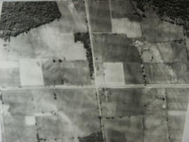
Aerial view of Coulson's Hill before 1960.
Bradford West Gwillimbury Public Library
Part of Local History Collection
Bradford West Gwillimbury Public Library
Part of Local History Collection
Part of Local History Collection
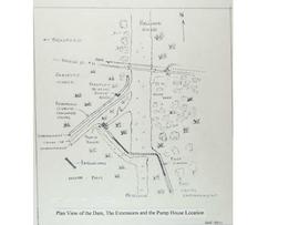
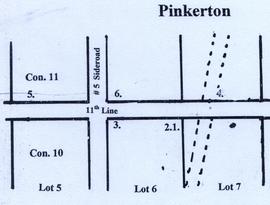
A map of Pinkerton in the 1800's.
Bradford West Gwillimbury Public Library
Part of Local History Collection
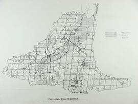
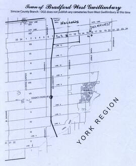
Map showing the Hollows and Deerhurst.
Bradford West Gwillimbury Public Library
Part of Local History Collection