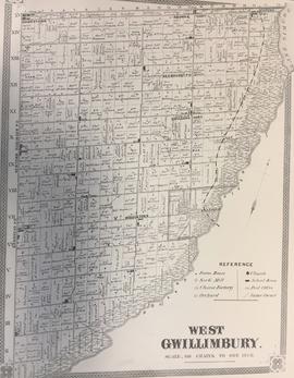
Township of West Gwillimbury Map c.1878
- CA BWGPL LHC-Map-2019-01-08-01
- Item
- 1878
Part of Local History Collection
Map of what West Gwillimbury looked like in approx. 1878.
Miles & Company
27 results directly related Exclude narrower terms
Township of West Gwillimbury Map c.1878
Part of Local History Collection
Map of what West Gwillimbury looked like in approx. 1878.
Miles & Company
Part of Local History Collection
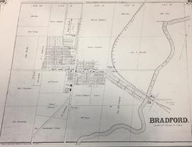
Map of what Bradford looked like in approx. 1878.
Miles & Company
Part of WEGWHIST Collection
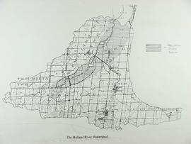
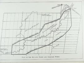
Contains information on the Holland Marsh in relation to Bradford's history. Headings include: Drainage 1 of 3 Drainage 2 of 3 Drainage 3 of 3 Hurricane Hazel Maps Marsh Disasters Marsh Hay Marsh History Photos Professor W.H. Day
Part of Local History Collection
Bradford West Gwillimbury Public Library
Part of Local History Collection
Part of Local History Collection
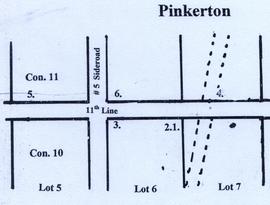
A map of Pinkerton in the 1800's.
Bradford West Gwillimbury Public Library
Part of Joe Saint fonds
Contains maps of the Bradford West Gwillimbury & surrounding areas
Joe Saint
Part of Oral History Collection
Summary of an interview with Sam Neilly. The interviewer is George Jackson. Sam and George discuss where Sam's friends and family lived in accordance with a map of Gilford they are looking at. See the Related Descriptions below for summary.
Bradford West Gwillimbury Public Library Archives
Part of Oral History Collection
Audio and summary of an interview with Sam Neilly. The interviewer is George Jackson. Sam and George discuss where Sam's friends and family lived in accordance with a map of Gilford they are looking at. See the Related Descriptions below for summary.
Bradford West Gwillimbury Public Library Archives
Part of Oral History Collection
Audio of an interview with Sam Neilly. The interviewer is George Jackson. Sam and George discuss where Sam's friends and family lived in accordance with a map of Gilford they are looking at. See the Related Descriptions below for summary.
Bradford West Gwillimbury Public Library Archives