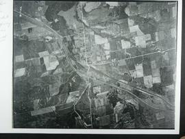
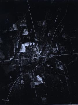
Aerial View of Holland Landing
- CA BWGPL OS9698
- 1946
Aerial view of Holland Landing before the divided highway was built.
9 resultados diretamente relacionados Excluir termos específicos
Aerial View of Holland Landing
Aerial view of Holland Landing before the divided highway was built.
Parte de Local History Collection
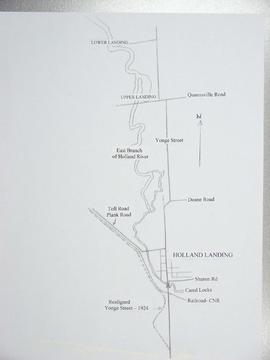
Map of Holland Landing showing realigned Yonge St.
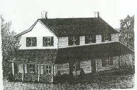
The Robinson's Inn, in Holland Landing scene here as a sketch by Simon Limbert that appeared in the Holland Landing newspaper. The caption read: "Robinson's Inn, which still stands today just south of Anchor Park, is among Holland Landing's oldest surviving buildings. The proprietor was Peter Robinson, one of the community's early entrepreneurs. He named the area on top of the hill north of the dam as Beverly, in honor of his uncle and brother.