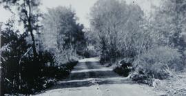
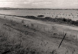
Canal Road prior to Hurricane Hazel
- CA BWGPL LHC-Dis-Hazel-PH9551
- Pièce
- 1950
Fait partie de Local History Collection
Dyke before Hurricane Hazel looking west from 416 Canal Rd.
Sans titre
42 résultats avec objets numériques Afficher les résultats avec des objets numériques
Canal Road prior to Hurricane Hazel
Fait partie de Local History Collection
Dyke before Hurricane Hazel looking west from 416 Canal Rd.
Sans titre
Fait partie de Local History Collection
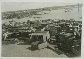
Crates along Hwy 400 after the marsh flooded during Hurricane Hazel
Sans titre
Fait partie de Local History Collection
Debris from the marshland piling up along Highway 400. Photograph from Betty Kennedy's 'Hurricane Hazel,' found in the Local History Collection.
Sans titre
Fait partie de Local History Collection
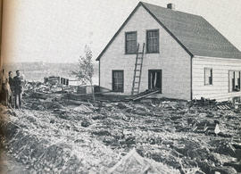
The dePeuter family standing next to their house, surrounded by debris. The debris came from the flood by Hurricane Hazel breaking the marsh's dykes.
Sans titre
Fait partie de Local History Collection
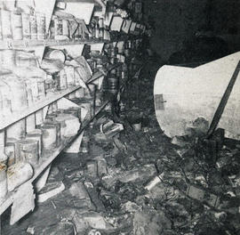
Interior of Auke Ellens' store, flooded by Hurricane Hazel breaking the marsh's dykes.
Sans titre
Fait partie de Local History Collection
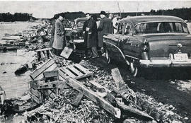
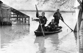
Holland Marsh farmers return home to salvage belonging. Photograph from in Betty Kennedy's 'Hurricane Hazel,' found in the Local History Collection.
Sans titre
Fait partie de Local History Collection
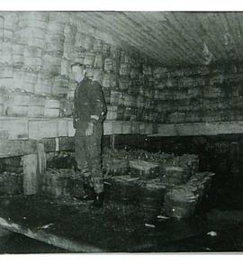
Bushels of carrots in storage following Hurricane Hazel.
Sans titre
Fait partie de Local History Collection
Municipality : West Gwillimbury
Community : Holland Marsh
Lot : 8
Concession : 3
Description : A flooded field facing north east from Hwy. 400 after Hurricane Hazel (Oct. 15, 1954). In the foreground is the service road that runs beside Hwy. 400 between Hwy. 9 and the Canal Road. Bags of harvested onions are stacked in the field.
Sans titre
Fait partie de Local History Collection
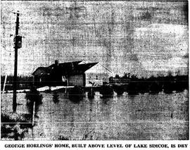
"George Horlings' Home, built above level of Lake Simcoe, is dry"
Sans titre
Fait partie de Local History Collection
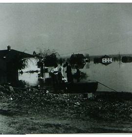
George Verkaik Sr.'s home following Hurricane Hazel.
Sans titre