Identity area
Reference code
CA BWGPL LHC-Dis-Hazel-PH74
Title
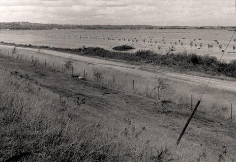
Flooded Onion Field
Date(s)
- 1954 (Creation)
Level of description
Item
Extent and medium
Photograph
Context area
Name of creator
Biographical history
Archival history
Immediate source of acquisition or transfer
Content and structure area
Scope and content
Municipality : West Gwillimbury
Community : Holland Marsh
Lot : 8
Concession : 3
Description : A flooded field facing north east from Hwy. 400 after Hurricane Hazel (Oct. 15, 1954). In the foreground is the service road that runs beside Hwy. 400 between Hwy. 9 and the Canal Road. Bags of harvested onions are stacked in the field.
Appraisal, destruction and scheduling
Accruals
System of arrangement
Conditions of access and use area
Conditions governing access
Conditions governing reproduction
Language of material
English
Script of material
Language and script notes
Physical characteristics and technical requirements
20x13 inches, mounted on foamboard

