- CA BWGPL LHC-Map-OS10130
- Item
Part of Local History Collection
Aerial View of the 5th Line and Simcoe Rd in Bradford West Gwillimbury.
Bradford West Gwillimbury Public Library
392 results with digital objects Show results with digital objects
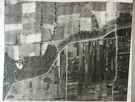
Part of Local History Collection
Aerial View of the 5th Line and Simcoe Rd in Bradford West Gwillimbury.
Bradford West Gwillimbury Public Library
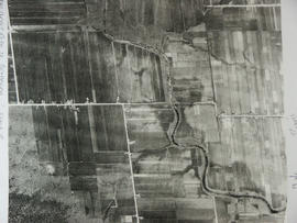
Aerial View - Road to Bradford
Part of Local History Collection
Aerial view of the direct road to Bradford, West is at the top of the page and North is on the right. Keele Street comes in form the left and Simcoe Road comes in from the right
Bradford West Gwillimbury Public Library
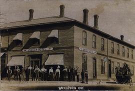
Part of Local History Collection
Looking north west in Bradford at the intersection of Holland Street and Yonge Street.
This is the northwest corner of the main intersection in Bradford. This building was first known as the Innis House. In 1906, it was called the Central Hotel, and ran by Peter Holt. He had purchased the property in 1899 from Mr. L. Algeo. It had 22 bedrooms, and two sitting rooms. It was heated by a furnace, and lighted by acetylene. At this time, it was the longest established hotel in Bradford, and was frequented by the farming community when they came into Bradford. In this picture, it is the Uneeda Hotel. It later became the Bank of Commerce and then the 11 and 88 Convenience Store. Today, it is the Coffee Culture cafe.
Bradford West Gwillimbury Public Library
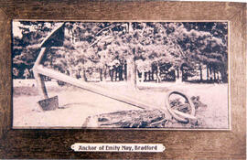
Part of Local History Collection
Picture of the Emity May Anchor in Anchor Park, Holland Landing. This anchor was made in England and was being transported to Lake Huron during the War of 1812. When the war ended the achor was no longer needed and it was abandoned in what is now Anchor Park.
Bradford West Gwillimbury Public Library
Part of Local History Collection
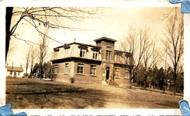
Photograph of the old Bradford Public School on Queen and Rebecca Streets
Bradford West Gwillimbury Public Library
Part of Local History Collection
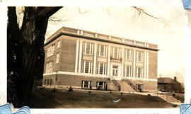
Photograph of the old Bradford High School on Queen Street
Bradford West Gwillimbury Public Library

Part of Local History Collection
Photo taken atop the Bradford Co-op of the truckloads of farmers bringing their produce to the market. The caption reads: "The above picture, taken from the roof of the Bradford Co-Operative Storage Ltd., shows only a section of the trucks, large and small, which formed the huge cavalcade of Holland Marsh growers and their vehicles, just before they moved off on their trek to Toronto City Hall to present to Mayor McCallum several truck-loads of vegetables for Toronto orphanages and the Hospital for Sick Children. Approximately 125 trucks made up a procession, about a mile and a quarter in length, which went right through with motorcycle police from Bradford to the City Hall without a stop."
More information in the Related Description links.
Bradford West Gwillimbury Public Library
Part of Local History Collection
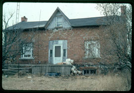
The Armstrong/Metcalfe home was located on the 6th line. It was reported to be the earliest brick house in West Gwillimbury. The centre gable was a later addition. The features include a basement kitchen, front Venetian windows and a nine-panel front door with original hardware. Because of the inability to access the house and property there is unfortunately no architectural records of this house. Demolished for subdivision
Bradford West Gwillimbury Public Library
Part of Local History Collection
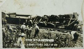
A train wreck occurred on the Grand Trunk Railway on July 15, 1908 between Bradford and Gilford.
Bradford West Gwillimbury Public Library
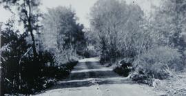
Canal Road prior to Hurricane Hazel
Part of Local History Collection
Dyke before Hurricane Hazel looking west from 416 Canal Rd.
Bradford West Gwillimbury Public Library