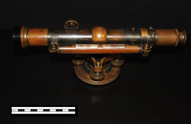
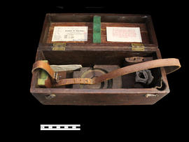
A Keuffel & Esser level that was used for activities such as surveying. It was originally owned by Professor William H. Day, who was integral to the Holland Marsh Drainage Scheme's beginnings. The survey of the marsh determined the elevation of the muck soil and the bordering "highland" soils, providing the information the planners would need to determine the grades, estimate the materials to be moved and to determine the alignment of the canal.
The drainage scheme report came out in 1924 and work began in the mid-1920s. The work involved intercepting part of the Holland River and the diversion of water around the perimeter of the area using drainage canals. Canal excavation materials were used to create dykes on the to-be reclaimed (marshland) side of the canals. The re-claimed land was used for farming and roads were constructed on top of the dykes to allow for transportation.
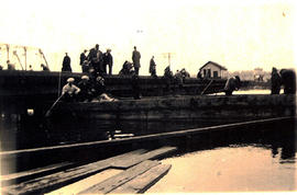
Photograph of the Holland River Bridge in 1920. The boat in the centre of the photograph are the hay-cutters of the Holland Marsh on the boat they would use to transport their daily work. This was prior to the marsh's drainage. Horses were transported up-river to work on the Marsh wearing wooden shoes. In the photograph, there are men fishing off the bridge, and on the right side (west of the bridge) you can see the water tower which trains used to fill up their water supply.
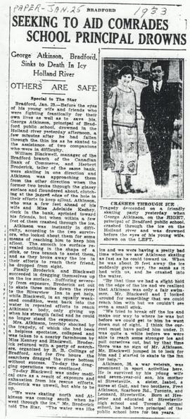
Newspaper article from the Toronto Star dated January 25th, 1933. Details the death of George Atkinson, Principal at the time of Bradford Public School.
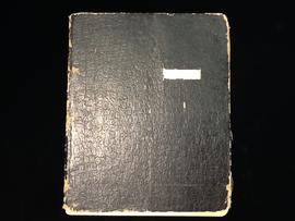
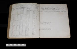
This notebook contains the levels taken and noted by Dave Sutherland for the Holland Marsh Reclamation Scheme. The second page states, "Holland Marsh reclamation scheme commencing at west side of Holland River going S.W. across marsh Feb 15/24."
This notebook contains the levels taken and noted by Dave Sutherland for the Holland Marsh Reclamation Scheme. The second page (as seen in this image) states, "Holland Marsh reclamation scheme commencing at west side of Holland River going S.W. across marsh Feb 15/24."
Ae box for an instrument, a Keuffel & Esser level.
Part of a collection of Professor William H. Day's work equipment, donated by Joe Saint. Both the case and level were originally owned by Professor William H. Day, who was integral to the Holland Marsh Drainage Scheme's beginnings. The equipment was traded to Len Saint in the 1930s for a truck. The survey of the marsh determined the elevation of the muck soil and the bordering "highland" soils, providing the information the planners would need to determine the grades, estimate the materials to be moved and to determine the alignment of the canal.