Showing 33 results

Archival description
Bradford West Gwillimbury Public Library Archives Holland River With digital objects
Print preview View:

Card of Thanks

An image of a card of thanks to the people of Bradford for their support, printed in the newspaper. It is related to the drowning of William Sutherland in the Holland River and is from his parents, Mr. & Mrs. Alex Sutherland.

Luanne Campbell Edwards

William Sutherland Drowning

Newspaper article dated 1889 from the South Simcoe News, describing the disappearance and drowning death of William Sutherland, son of Alexander and Elizabeth Sutherland.

Luanne Campbell Edwards

George Atkinson Ice Death

Newspaper article from the Toronto Star dated January 25th, 1933. Details the death of George Atkinson, Principal at the time of Bradford Public School.

Luanne Campbell Edwards

Storage Box for Professor Day's Level

Ae box for an instrument, a Keuffel & Esser level.

Part of a collection of Professor William H. Day's work equipment, donated by Joe Saint. Both the case and level were originally owned by Professor William H. Day, who was integral to the Holland Marsh Drainage Scheme's beginnings. The equipment was traded to Len Saint in the 1930s for a truck. The survey of the marsh determined the elevation of the muck soil and the bordering "highland" soils, providing the information the planners would need to determine the grades, estimate the materials to be moved and to determine the alignment of the canal.

Joe Saint

Keuffel and Esser Level

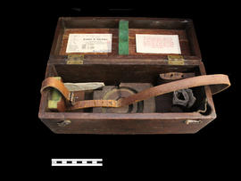
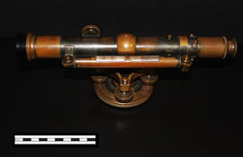
A Keuffel & Esser level that was used for activities such as surveying. It was originally owned by Professor William H. Day, who was integral to the Holland Marsh Drainage Scheme's beginnings. The survey of the marsh determined the elevation of the muck soil and the bordering "highland" soils, providing the information the planners would need to determine the grades, estimate the materials to be moved and to determine the alignment of the canal.

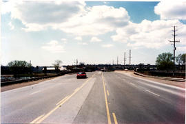
The drainage scheme report came out in 1924 and work began in the mid-1920s. The work involved intercepting part of the Holland River and the diversion of water around the perimeter of the area using drainage canals. Canal excavation materials were used to create dykes on the to-be reclaimed (marshland) side of the canals. The re-claimed land was used for farming and roads were constructed on top of the dykes to allow for transportation.

Joe Saint

Book of Levels - Inside View

This notebook contains the levels taken and noted by Dave Sutherland for the Holland Marsh Reclamation Scheme. The second page (as seen in this image) states, "Holland Marsh reclamation scheme commencing at west side of Holland River going S.W. across marsh Feb 15/24."

Dave Sutherland

Results 1 to 10 of 33