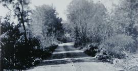
Canal Road prior to Hurricane Hazel
- CA BWGPL LHC-Dis-Hazel-PH9551
- Unidad documental simple
- 1950
Parte deLocal History Collection
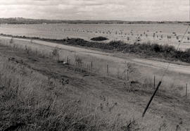
Dyke before Hurricane Hazel looking west from 416 Canal Rd.
Sin título
33 resultados con objetos digitales Muestra los resultados con objetos digitales
Canal Road prior to Hurricane Hazel
Parte deLocal History Collection
Dyke before Hurricane Hazel looking west from 416 Canal Rd.
Sin título
Parte deLocal History Collection
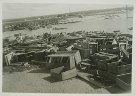
Crates along Hwy 400 after the marsh flooded during Hurricane Hazel
Sin título
Parte deLocal History Collection
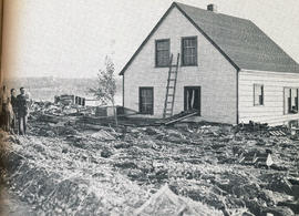
The dePeuter family standing next to their house, surrounded by debris. The debris came from the flood by Hurricane Hazel breaking the marsh's dykes.
Sin título
Parte deLocal History Collection
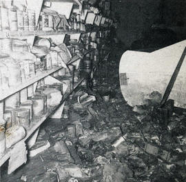
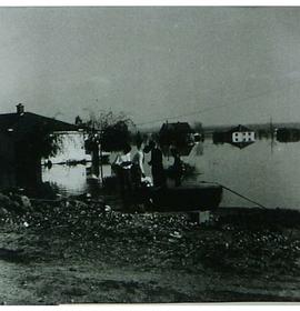
Interior of Auke Ellens' store, flooded by Hurricane Hazel breaking the marsh's dykes.
Sin título
Parte deLocal History Collection
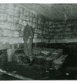
Bushels of carrots in storage following Hurricane Hazel.
Sin título
Parte deLocal History Collection
Municipality : West Gwillimbury
Community : Holland Marsh
Lot : 8
Concession : 3
Description : A flooded field facing north east from Hwy. 400 after Hurricane Hazel (Oct. 15, 1954). In the foreground is the service road that runs beside Hwy. 400 between Hwy. 9 and the Canal Road. Bags of harvested onions are stacked in the field.
Sin título
Parte deLocal History Collection
George Verkaik Sr.'s home following Hurricane Hazel.
Sin título
Parte deLocal History Collection
Harry Verkaik's barn on River Road after Hurricane Hazel.
Sin título

Parte deLocal History Collection
Photo is taken facing north prior to the flood of Hurricane Hazel (October 15, 1954) Lettuce in foreground is #9654 lettuce. Hand dug ditch is also illustrated.
Sin título
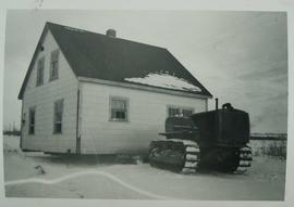
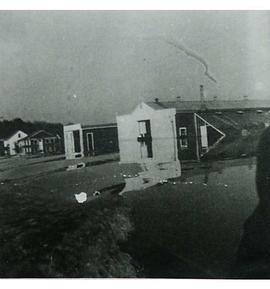
House relocated after Marsh flood
Parte deLocal History Collection
House being relocated after the Holland Marsh flooded.
If you have any information on this picture, please contact the Library at 905-775-3328.
Sin título