Área de elementos
Taxonomía
Código
Nota(s) sobre el alcance
Nota(s) sobre el origen
Mostrar nota(s)
Términos jerárquicos
Map
Términos equivalentes
Map
Términos asociados
Map
Término Relacionado Drawing
Término Relacionado Drawing
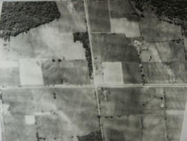
Aerial view of Coulson's Hill before 1960.
Sin título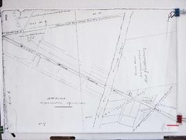
Copy of part of a map of Joseph Street as part of Registered Plan 122A. Captured in the copy is a couple of handwritten notes, including the name "John Bateman."
Sin títuloAudio and summary of an interview with Sam Neilly. The interviewer is George Jackson. Sam and George discuss where Sam's friends and family lived in accordance with a map of Gilford they are looking at. See the Related Descriptions below for summary.
Sin título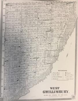
Map of what West Gwillimbury looked like in approx. 1878.
Sin título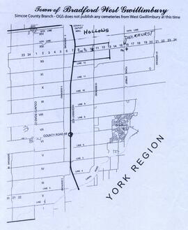
Map showing the Hollows and Deerhurst.
Sin título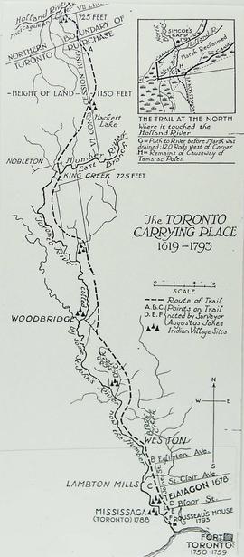
This drawing is a map of Bond Head in the 1860's based on historical data of the era.
Contains information on the Holland Marsh in relation to Bradford's history. Headings include: Drainage 1 of 3 Drainage 2 of 3 Drainage 3 of 3 Hurricane Hazel Maps Marsh Disasters Marsh Hay Marsh History Photos Professor W.H. Day