- CA BWGPL LHC-Map-OS11009
- Unidad documental simple
Parte deLocal History Collection
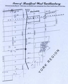
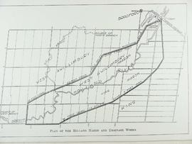
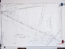
Map showing the Hollows and Deerhurst.
Sin título
27 resultados directamente relacionados Excluir términos relacionados
Parte deLocal History Collection
Map showing the Hollows and Deerhurst.
Sin título
Parte deLocal History Collection
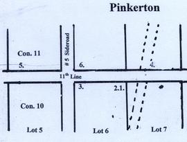
A map of Pinkerton in the 1800's.
Sin título
Parte deLocal History Collection
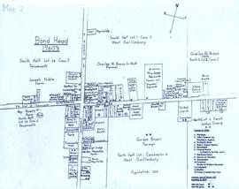
A map of Bond Head in the 1960's, including the main residents, active churches, and lot designations of the town.
Parte deLocal History Collection
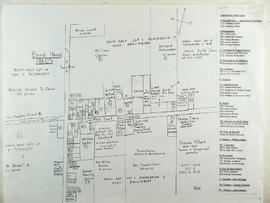
This drawing is a map of Bond Head in the 1860's based on historical data of the era.
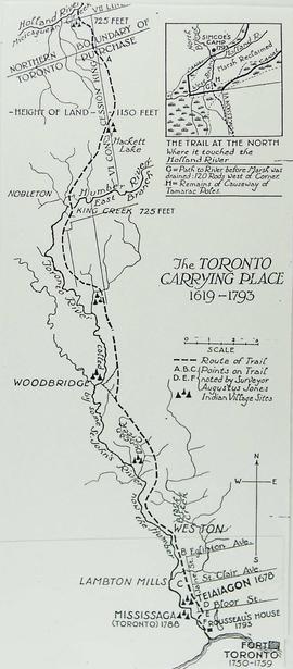
Map of the Toronto Carrying Place
Parte deLocal History Collection
Sin título
Parte deLocal History Collection
Parte deLocal History Collection
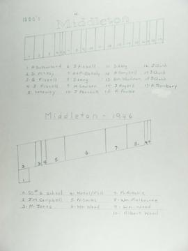
The top map shows Middleton as of the 1880's and the bottom map shows Middleton in 1946.
Parte deLocal History Collection
Parte deLocal History Collection
Parte deLocal History Collection
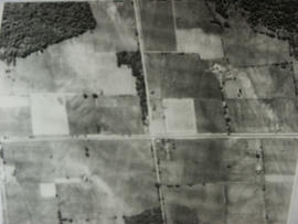
Aerial view of Coulson's Hill before 1960.
Sin título