Identity area
Reference code
Title
Date(s)
- 2016 (Creation)
Level of description
Extent and medium
Newspaper Article
Context area
Name of creator
Biographical history
Archival history
Immediate source of acquisition or transfer
Content and structure area
Scope and content
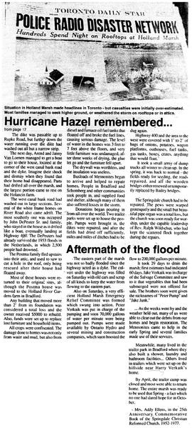
Description : The flooding of the Marsh on October 15th, 1954, is one occasion not easily forgotten by those who were part of the Springdale community at that time. It had already rained for weeks. We were behind in the harvesting, and most of the onions were still in the field, bagged up and stacked in long rows. On that Friday, October 15th the rain kept pouring down, and an all-time record of 7" of rain was recorded for the Toronto area. Hurricane Hazel had entered the mainland just south of Myrtle Beach, leaving a path of destruction and devastation with winds over 90 miles per hour, and torrential rains. It crossed Lake Ontario near Toronto. At 7:30 p.m. that Friday we received a phone call to leave for higher ground. Laying sandbags on the dikes had proven a hopeless task, as the water that came roaring down from the surrounding hills was just too much. We put some suitcases on the truck and left our house. For a few minutes, the rain stopped, the sky was clear above, and the stillness was eerie. Then it started again: the wind, the rain, the darkness. The roads were full of gullies. Weston Road, then the 6th Concession of King Twp., was under construction, and turned into a river of mud. The water in the canal was close to the top of the dike. I got out of the truck to check whether the bridge was still there. We followed the townline eastward. A 3' wide creek east of Highway 400 had turned into a raging river, boiling 2' high over the small bridge. About 10 cars were standing there, the drivers debating whether it was safe to cross. One look was enough. We turned around and went back to the wooden canal bank road to Wist Road. This road was also full of gullies, washed out by the water coming down from the 400. While travelling south on the 400, we encountered a huge landslide just south of highway 9. The whole side of the hill had slid down, all but blocking the southbound lanes. A Gray Coach bus was lying on its side in the median. That was enough. We turned off at the Aurora side road and sought refuge at the farmhouse of George and Helen Sportel. Already 30 people were there. The men slept downstairs and the women and children upstairs, where the bedrooms were, We had no blankets, beds or pillows for the men, but at least we were high and dry. At 11 p.m., I went back to take a look at our house. It was still there, but the land was under water, and water levels were creeping up the driveway. When I tried to drive a little further, the road disappeared under water. I brought some furniture upstairs, but still did not think that the water would reach the floor, which at that time was still at least 2' above the flood. The next morning at 6 a.m., we climbed a hill, and saw a Holland Marsh that was now a large lake. Only the roofs of the houses seemed to be above the water. It was a cold, still morning, but sunny, and for the first time in weeks it was not raining.
Appraisal, destruction and scheduling
Accruals
System of arrangement
Conditions of access and use area
Conditions governing access
Conditions governing reproduction
Language of material
English
Script of material
Language and script notes
Physical characteristics and technical requirements
Finding aids
Bradford West Gwillimbury Times
October 5, 1994
Vol. 4, No. 40
Pg 17
Microfilm Reel # 107
Allied materials area
Existence and location of originals
Existence and location of copies
Related units of description
Notes area
Alternative identifier(s)
Access points
Subject access points
Place access points
Name access points
- Edo N. Knibbe (Subject)