- CA BWGPL WEG-Mar-PH25683
- Item
Part of WEGWHIST Collection
Description : Early Days of the Marsh
Today, one of the richest and most widely known Garden Tracts in Ontario is the Bradford or the Holland Marsh. In the vegetable stores across Canada and in parts of the United States you will see potatoes, celery, lettuce, onions, and carrots, etc., bearing the label "Bradford Marsh" or simply "Marsh" as a sign of quality. But, the Bradford Marsh was not always a gardener's paradise. Unbelieveable as it may now seem, it was once nothing but an impassable marsh of Tamarack swamp, covering thousands of acres.
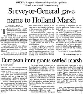
Beginning about Schomberg and flowing, or moving in a very sluggish manner in a northeasterly direction towards Lake Simcoe is the stream known as the Holland River, so named after a Major S. Holland, Surveyor General of Canada, who in 1971 visited the river in making a general survey of the Lake Simcoe region. This is the main river and it is joined by an eastern or Holland Landing tributary at a place called Soldier's Landing or Soldier's Bay about seven miles from the mouth. At one time, navigation to Lake Simcoe points from Soldier's Landing consisted of small craft. In 1850, when boats were larger and the western or main branch of the river was found to be much easier to navigate, having deeper water and broader streams and not so choked with marsh as the eastern branch, the steamer "Beaver" went on to the Bradford Holland River Bridge.
In 1819, the first settlers in South Simcoe, the Wallaces, the Armstrongs and the Algeos, crossed the river with great difficulty and landed at what is now known as the old wharf in the Scotch Settlement. Here for some years was the only river crossing and that was by a ferry pulled by ropes.
But by this time, the settlement at Bradford had become an accomplished fact and the question of some method of crossing the marsh and so as to give easier access to the Holland Landing had arisen. Petitions were sent to county councils and to the Government and finally under the constant urging of William Armson, Reeve of West Gwillimbury and Warden of the County, money grants were given and a road was made from Bradford to the river by laying logs across a width of marsh and filling in with earth. This was the corduroy road, the logs of which were still visible many years afterwards. Then to cross the river a floating bridge was laid down and a through direct road from Bradford to the Landing was completed and the Marsh was at least partly conquered. The ferry at the old wharf was discontinued.
In 1837 George Lount, Government Surveyor, surveyed as a townsite, the spot on the south side of the river just beyond the floating bridge, known as Amsterdam and the streets were laid out bearing such good Holland names as DeRuyder, DeWitt, VanDyke, Rubens, etc., but the townsite remained as only a townsite and no town arose, so in 1869 a lumberman named Thompson Smith acquired the patent of the unused site and built two sawmills, one on each side of the road just beyond the bridge. And the marsh was still largely unconquered. Rafts of logs were brought up the river by the tugs Victoria and Isabella, and this helped to keep the river fairly clear of weeds. The wreck of the Isabella lay near the railway bridge not so many years ago and it now probably lying on the bottom of the river.
The superintendent of the sawmills was James Durham and in 1870, Mr. Durham cut the floating bridge in two in order to get his logs through and this caused a lot of trouble but led to the erection of a bridge above the water. This bridge was 420 feet long and was complete in April 1871, the builder being Thomas McKonkey of Gilford.
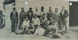
To the many men working in the mills the great marsh became a familiar sight and the thought entered someone's head, why not cut that marsh grass or hay, twist it into ropes and sell it, and so was born the marsh hay industry and some use at last was made of the great wasts of land. The hay was twisted into long ropes. Later, hay-balers were brought into use and the hay was baled instead of twisted into ropes.This marsh hay was used for stuffing mattresses. Marsh hay twisting and baling went on for years and might still be the only marsh industry had not a bright idea entered the head of one D. W. (Dane) Watson, an intelligent, energetic young farmer of the Scotch Settlement who, however, had come into Bradford and acquired a grocery business where the Village Inn now stands.
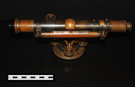
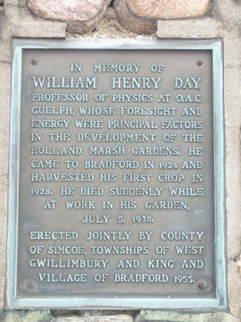
This bright idea was, why not dredge a canal and drain the marsh and so turn waste land into productive soil? Mr. Watson got Professor Day of Guelph Agricultural College, interested in his idea and so was laid the germ that has sprouted into the now famous Bradford Marsh Gardens.
Bradford Witness