Zone des éléments
Référentiel
Code
Note(s) sur la portée et contenu
Note(s) sur la source
Note(s) d'affichage
Termes hiérarchiques
Map
Termes équivalents
Map
Termes associés
Map
Terme associé Drawing
Terme associé Drawing
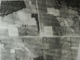
Aerial view of Coulson's Hill before 1960.
Sans titre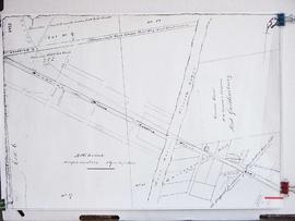
Copy of part of a map of Joseph Street as part of Registered Plan 122A. Captured in the copy is a couple of handwritten notes, including the name "John Bateman."
Sans titreAudio and summary of an interview with Sam Neilly. The interviewer is George Jackson. Sam and George discuss where Sam's friends and family lived in accordance with a map of Gilford they are looking at. See the Related Descriptions below for summary.
Sans titre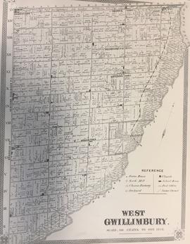
Map of what West Gwillimbury looked like in approx. 1878.
Sans titre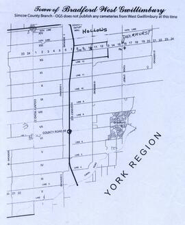
Map showing the Hollows and Deerhurst.
Sans titre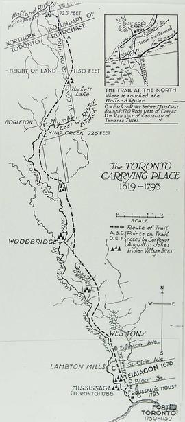
This drawing is a map of Bond Head in the 1860's based on historical data of the era.
Contains information on the Holland Marsh in relation to Bradford's history. Headings include: Drainage 1 of 3 Drainage 2 of 3 Drainage 3 of 3 Hurricane Hazel Maps Marsh Disasters Marsh Hay Marsh History Photos Professor W.H. Day