- CA BWGPL JS-Vol3-JSC-v3-1910
- Stuk
Part of Joe Saint fonds
Contains maps of the Bradford West Gwillimbury & surrounding areas
Zonder titel
27 results directly related Exclude narrower terms
Part of Joe Saint fonds
Contains maps of the Bradford West Gwillimbury & surrounding areas
Zonder titel
Joseph Street (by Registered Plan 122A)
Part of Local History Collection
Copy of part of a map of Joseph Street as part of Registered Plan 122A. Captured in the copy is a couple of handwritten notes, including the name "John Bateman."
Zonder titel
Part of Local History Collection
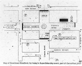
Map of how Downtown Bradford would be set-up for Carrotfest, printed in the Bradford West Gwillimbury Times.
Zonder titel
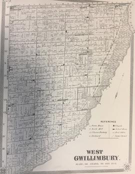
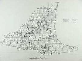
Township of West Gwillimbury Map c.1878
Part of Local History Collection
Map of what West Gwillimbury looked like in approx. 1878.
Zonder titel
Part of Local History Collection
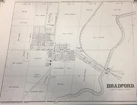
Map of what Bradford looked like in approx. 1878.
Zonder titel
Part of Local History Collection
Index to the Map & Plan Collection held in the Bill & Erica Marks Archive Room.
Zonder titel
Part of Local History Collection
Part of Local History Collection
Zonder titel
Part of Local History Collection
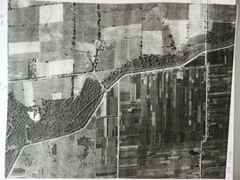
Aerial View of the 5th Line and Simcoe Rd in Bradford West Gwillimbury.
Zonder titel