- CA BWGPL LHC-Map-OS11377
- Unidad documental simple
- 1860s
Parte deLocal History Collection
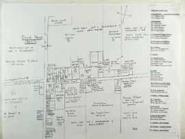
This drawing is a map of Bond Head in the 1860's based on historical data of the era.
27 resultados directamente relacionados Excluir términos relacionados
Parte deLocal History Collection
This drawing is a map of Bond Head in the 1860's based on historical data of the era.
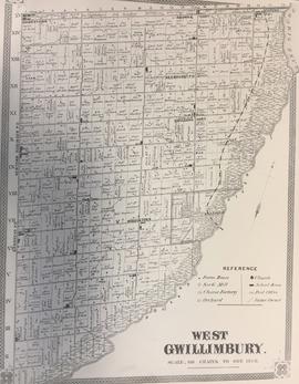
Township of West Gwillimbury Map c.1878
Parte deLocal History Collection
Map of what West Gwillimbury looked like in approx. 1878.
Sin título
Parte deLocal History Collection
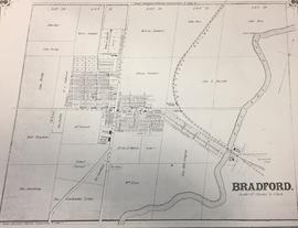
Map of what Bradford looked like in approx. 1878.
Sin título
Parte deLocal History Collection
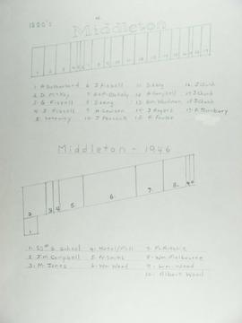
The top map shows Middleton as of the 1880's and the bottom map shows Middleton in 1946.
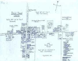
Parte deLocal History Collection
A map of Bond Head in the 1960's, including the main residents, active churches, and lot designations of the town.
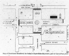
Parte deLocal History Collection
Map of how Downtown Bradford would be set-up for Carrotfest, printed in the Bradford West Gwillimbury Times.
Sin título
Parte deOral History Collection
Audio and summary of an interview with Sam Neilly. The interviewer is George Jackson. Sam and George discuss where Sam's friends and family lived in accordance with a map of Gilford they are looking at. See the Related Descriptions below for summary.
Sin título
Parte deOral History Collection
Audio of an interview with Sam Neilly. The interviewer is George Jackson. Sam and George discuss where Sam's friends and family lived in accordance with a map of Gilford they are looking at. See the Related Descriptions below for summary.
Sin título
Parte deOral History Collection
Summary of an interview with Sam Neilly. The interviewer is George Jackson. Sam and George discuss where Sam's friends and family lived in accordance with a map of Gilford they are looking at. See the Related Descriptions below for summary.
Sin título