Identity area
Reference code
CA BWGPL LHC-Map-2019-01-08-02
Title
Town of Bradford Map c.1878
Date(s)
- 1878 (Creation)
Level of description
Item
Extent and medium
Map
Context area
Name of creator
Biographical history
Archival history
Immediate source of acquisition or transfer
Content and structure area
Scope and content
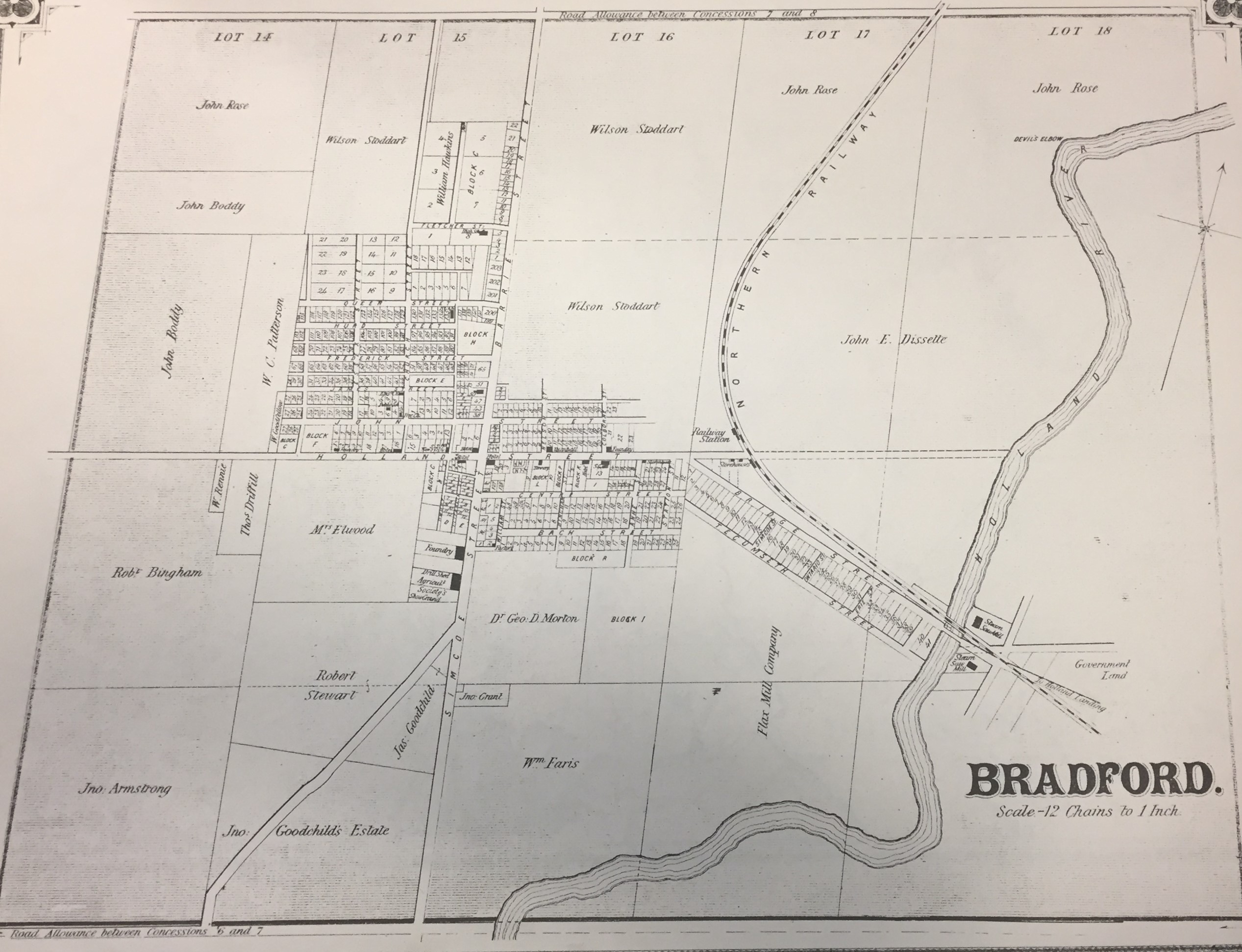
Map of what Bradford looked like in approx. 1878.
Appraisal, destruction and scheduling
Accruals
System of arrangement
Conditions of access and use area
Conditions governing access
Conditions governing reproduction
Language of material
Script of material
Language and script notes
Physical characteristics and technical requirements
Finding aids
Allied materials area
Existence and location of originals
Existence and location of copies
Related units of description
Notes area
Note
Click on image to enlarge
Alternative identifier(s)
Access points
Place access points
Name access points
Genre access points
Description control area
Description identifier
Institution identifier
Rules and/or conventions used
Status
Level of detail
Dates of creation revision deletion
Language(s)
Script(s)
Sources
Map can be found in the "Illustrated Historical Atlas of the County of York and the Township of West Gwillimbury & Town of Bradford in the County of Simcoe Ontario," published by Miles & Company in 1878 and re-printed in 1972.